Road engineering / what the surface tells you
INSIDE THE HAIRPIN
A mountain road is an engineered compromise between terrain, drainage, access and available space. Reading its geometry helps explain what may be hidden ahead; it does not replace observation, signs or a suitable riding pace.
The road responds to the slope
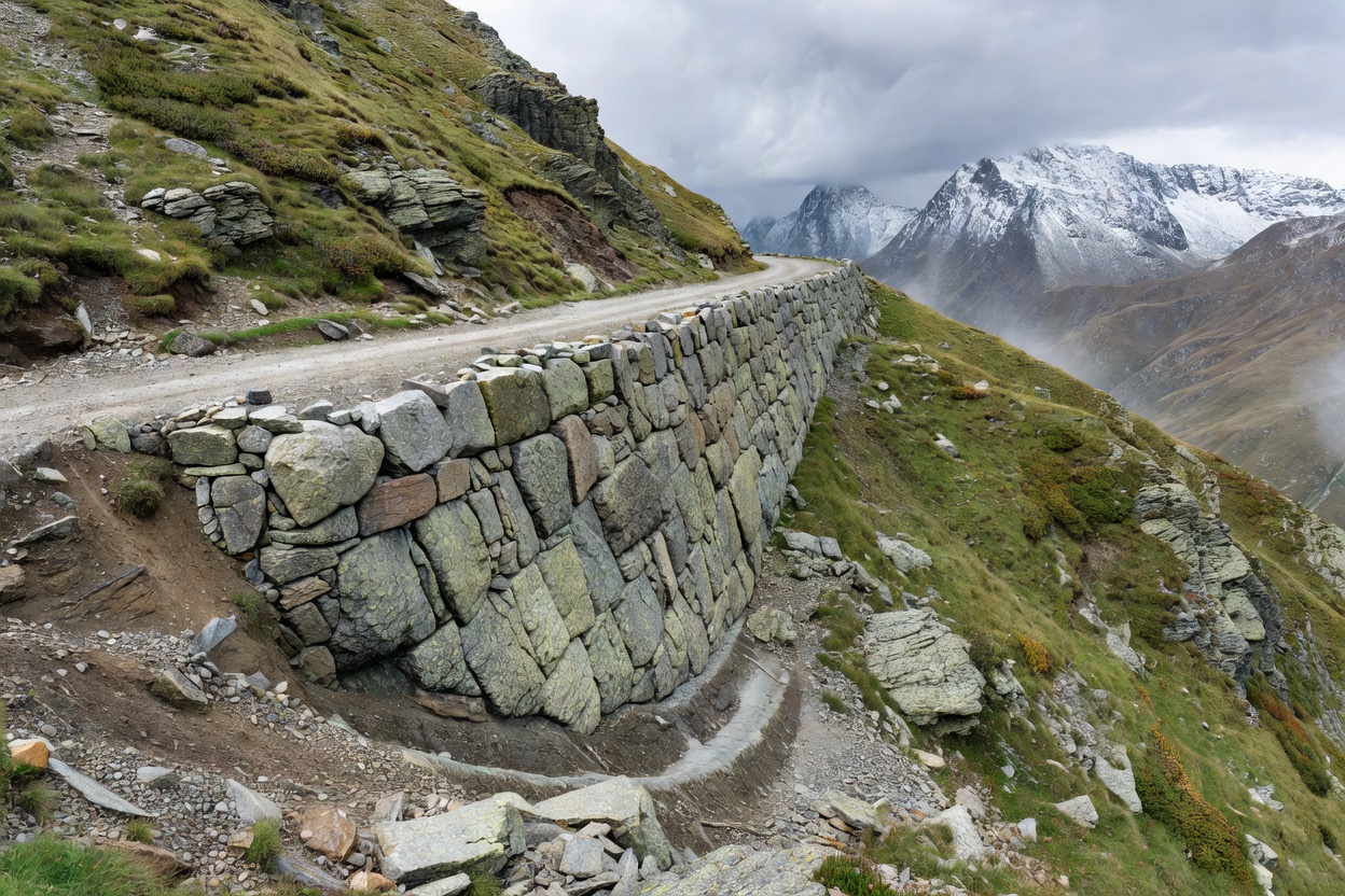
Road designers rarely have the luxury of drawing a straight, level line through steep terrain. The alignment must gain or lose elevation while negotiating ridges, valleys, unstable ground, watercourses and existing settlements. A route may follow a contour for a time, cross a slope diagonally, then reverse direction in a hairpin to continue climbing. The visible road is only one part of a larger structure that includes drainage, retaining works, cut slopes and the landscape above and below it.
Gradient describes how quickly elevation changes along the road. A sustained climb can influence engine temperature, traction and rider workload; a sustained descent places repeated demands on braking and attention. The same nominal gradient can feel different depending on bend frequency, surface quality, vehicle load, weather and the length of the section. Published road profiles may be useful context, but they should not be read as a guarantee of how a particular segment feels on the day.
Why hairpins need patience
A hairpin is a tight turn that lets a road change direction within constrained terrain. Its geometry may include a steep approach, a changing radius, a narrow apex, an uneven surface or an adverse camber. The curve can also be partly hidden by a rock face, wall or vegetation. Riders may see the direction of the bend without seeing its full exit, its surface, or traffic arriving from the other side.
For this reason, a hairpin should be approached as a visibility problem as much as a steering problem. Reduce speed early enough to preserve choices, position only where sight lines and lane rules allow, and leave room for the possibility that another vehicle needs more of the road. A larger vehicle can cross near the centre or require extra room at the bend. Do not assume the road is yours because the approach looks clear. Avoid crossing lane markings or treating a familiar turn as a place to demonstrate skill.
On a descent, repeated corners can compound fatigue. Braking technique and gear selection should follow the motorcycle manufacturer’s guidance and the rider’s training. If the route is unfamiliar, wet or steep, a conservative pace and frequent safe pauses are sensible. There is no benefit in arriving at the next curve with less margin than the previous one.
Camber, drainage and surface changes
Camber is the cross-slope of the road surface. It often helps direct water toward drains, but the profile can change through a bend, at a junction or near a road edge. A surface that appears level from a distance may fall away, rise toward a crown or contain a patch that has settled. These details matter because they influence how the motorcycle meets the road, particularly at low speed or when the surface is wet.
Drainage features tell a story about water. Grates, channels and culverts move runoff away from the carriageway, while deposits of gravel or debris may indicate water has crossed it recently. Shaded cuts can remain damp after exposed slopes dry. Frost, mud, fallen stones and leaf litter are all possible in mountain environments. Road maintenance can change the surface from one visit to the next, so descriptions should not be mistaken for a condition report.
Sight distance and roadside structures
Sight distance is the length of roadway visible to a person travelling along it. The usable view can be limited by a crest, bend, tunnel portal, cut slope, bridge parapet, retaining wall or vegetation. A wall may protect a steep drop, yet also block a view into a curve. A tunnel entrance changes light levels, and a bridge can narrow the usable roadway. These are not signals to make a hurried adjustment; they are reasons to leave time and room for what cannot yet be seen.
Roadside protection varies by location and design. Guardrails, parapets and markers are built for particular conditions and may be interrupted at access points. They do not make a corner safe at any speed, nor do they guarantee that loose material or weather cannot affect the road. A cliff face can shelter one side from wind while a ridge ahead remains exposed. A tunnel can be dry at its portal and wet within. Treat each transition as a fresh observation.
Reading diagrams and route descriptions
Engineering sketches can clarify the relation between slope, road platform and retaining works. A plan view shows alignment from above; a profile illustrates elevation change; a cross-section shows how the platform sits across the hillside. None provides live information about traffic, closures or surface condition. When a graphic simplifies a road, use it to understand a principle, not to predict a precise line or safe speed.
Where a route guide mentions a narrow section, a sequence of hairpins or a tunnel, translate that note into planning questions. Is there room to meet larger traffic? Are there safe places to pause before the demanding section? Will weather or darkness make visibility worse? Is an alternative available if a closure or discomfort changes the day? These are useful questions because they connect engineering context to decisions a rider can make before setting out.
Respect the design limits
Mountain roads serve many purposes: local travel, freight, public transport, maintenance, emergency response and tourism. Their constraints are often visible in tight alignments, limited shoulders and protective works. A rider is a guest in a shared transport corridor, not its only user. Follow posted limits and temporary controls, allow space for cyclists and walkers, and never stop in a place that blocks sight lines or access.
When the geometry feels difficult, simplify the plan. Slow down within the law, leave more following distance, stop at a safe location if needed, or choose a less demanding route. The road’s design explains why the work is challenging; it does not require you to continue regardless of conditions. The practical lesson is simple: read the terrain, preserve margin, and let the road reveal itself one visible section at a time.